

Leaderboard
-


Sly Western
IPS MEMBER3Points5Posts -


kinzyjr
IPS MEMBER2Points6,897Posts -
(1600x718).jpg.489f0676b133a93002d2fc86d3d6dfe3.jpg)
(173x200).thumb.jpg.87642ce613f801fde119db608b8aeb96.jpg)
Silas_Sancona
IPS MEMBER1Points12,540Posts -

Ben G.
IPS MEMBER1Points775Posts
Popular Content
Showing content with the highest reputation on 09/02/2026 in Posts
-
It will be interesting to see how they hold up to the non-stop heat and humidity here. Cold shouldn't be that much a concern.1 point
-
 We’re looking for passionate palm growers from around the world to join us as guests on The Palmcast. One of the reasons we started the show is that we see incredible gardens, photos, and written posts here on PalmTalk and elsewhere all the time. The Palmcast gives us a chance to bring the people behind those collections to life—to actually talk with them, tour their gardens through their photos, hear the stories behind the plants, and ask questions that don’t always come up in a forum post. We record remotely, and guests usually put together a PowerPoint or slide deck with photos of their palms, garden, climate, experiments, successes, failures, or anything else they want to share. The pictures guide the conversation. We’ve already had some incredible guests including Dr. Kyle Brown, Dr. David Creech, Banana Joe Clemente, Hayes Jackson, M.L. Robinson, Tom McClendon, Joe LeVert, and James Spann. And we have a great lineup coming, including Dr. Scott Zona, Gary Hollar, Horace Hobbs, Felicia Garza, Dave Alvarez, Tony Cerbone, Fiona Corinne von Grey, Bob McCartney, Phil Bennion, and William Huie. We’d especially like to feature more growers from PalmTalk—mature gardens, unusual collections, long-term growing experience, interesting climates, zone pushing, or just a great palm story. We’d also love to showcase more collections from around the world. Interested? Send a private message to either @Sabal King or @Teddys Nursery here on PalmTalk and we’ll get in touch. 🌴 Watch The Palmcast on YouTube: https://www.youtube.com/@ThePalmcast1 point
 -
1 pointUnfortunately, they are all out in the garden beds at this point. If I come across one that doesn't have a home, I'll keep you in mind.1 point
-
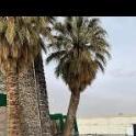 Pavestones will work, the heavy stone or concrete ones are best, with about 1/3 buried. Have multiple filifera, a trachy, and med palm. Some of them.....red circle is 1 year old seedlings(triple filifera), surrounded by rocks. Rocks removed when true trunks appear (5-8 years).
 1 point
 -
That's a great suggestion! Thank you. Do you think pavestones would also work? Do you have any other palms in your yard?1 point
-
Wow! That's huge! Washingtonias are fast and furious growers. Did you start yours from seed?1 point
-
@SailorBold I haven’t seen any established palms around Payson either. I hope my neighbors don’t hate me! 😅I definitely get the feeling that because we’re relatively close to the expansive palm-scape of the Valley, most Payson residents would much rather see pine trees than palm trees. I get it; pine trees are awesome! To your point, however, there are still plenty of large succulents all over town like trunked yuccas, agaves (like Agave chrysantha), desert spoons, chollas, and large-pad prickly pears. In other words, there are many visual cues that Payson sits right at the junction between two different climate zones; it is not a true cold-winter mountain town. I love the eclectic mix of native flora here, and so I figured, why not make it more eclectic? 😂🌴1 point
-
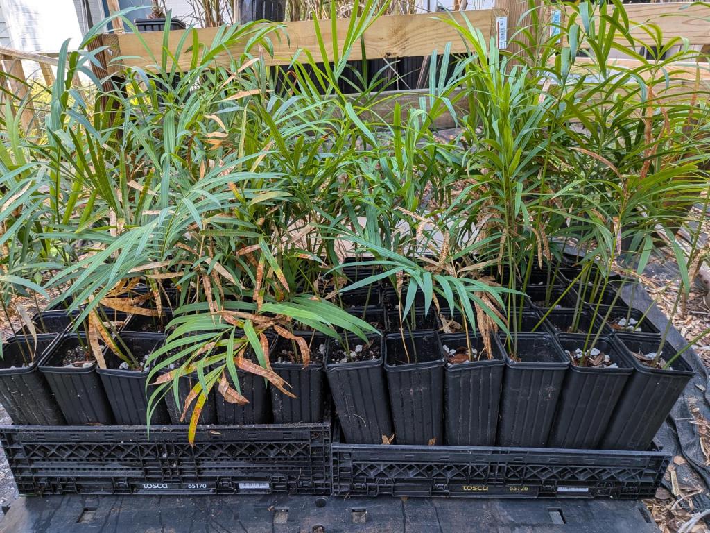
 Two year old hybrid cross of Cycas panzhihuaensis x multifrondis. Been holding on to these until they started showing split leafs. Plants pictured are examples of what I have growing, as I have about 75 of these. Currently growing in 4x4x12 Stuewe deep pots. Plants will be shipped bare root in damp peat moss. I can ship multiple plants per box. Price including shipping listed below. 1 - $50 2 - $95 3 - $135 4 - $175 If you desire more than 4 plants message me. Payment accepted via PayPal or Venmo. Apologies in advance, but absolutely NO shipping to California or Arizona. Thanks.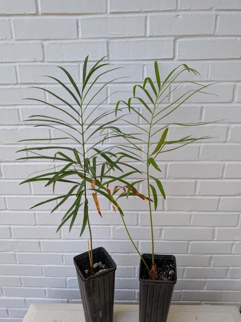


 1 point
 -
That's good growth. It will pick up even more speed over the next season or two. Here is what two years of growth looks like on mine. Memorial Day 2024: And today:

 1 point
 -
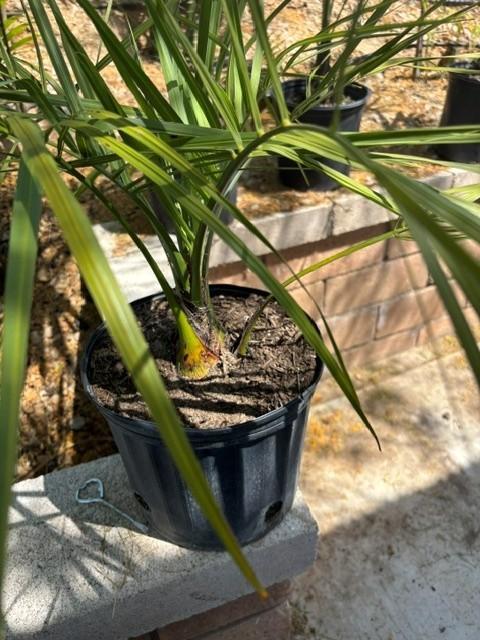
 I ordered a couple extra per interest. May go quick. These 3's are overgrown could be 7's. 120.00 for the JUBAUITA and 95.00 for the Trachycarpus both are rare and hard to find in this size. Willing to ship to most US states. The Butia x Jubaea (sometimes called "Jubutia") is a highly prized hybrid palm that crosses Butia odorata (Pindo Palm) with Jubaea chilensis (Chilean Wine Palm), combining the extreme cold hardiness of both parents. It features a massive, thick trunk and faster growth (hybrid vigor) than either parent, making it ideal for temperate climates, with hardiness often reaching down to \(10^{\circ }F\) Considered by Gibbons and Spanner to be the most elegant species of windmill palm, this Himalayan native will eventually reach 30' tall when very happy. Our offering is the Nepal Form of the species which has slightly smaller leaves and is far more cold hardy than normal. If you enjoy experimenting with new, possibly hardy palms, then this fast-growing windmill is a must.
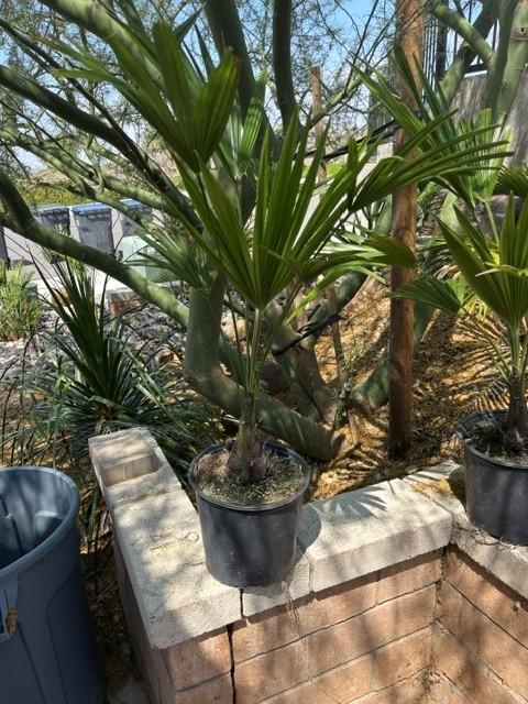
 1 point
 -
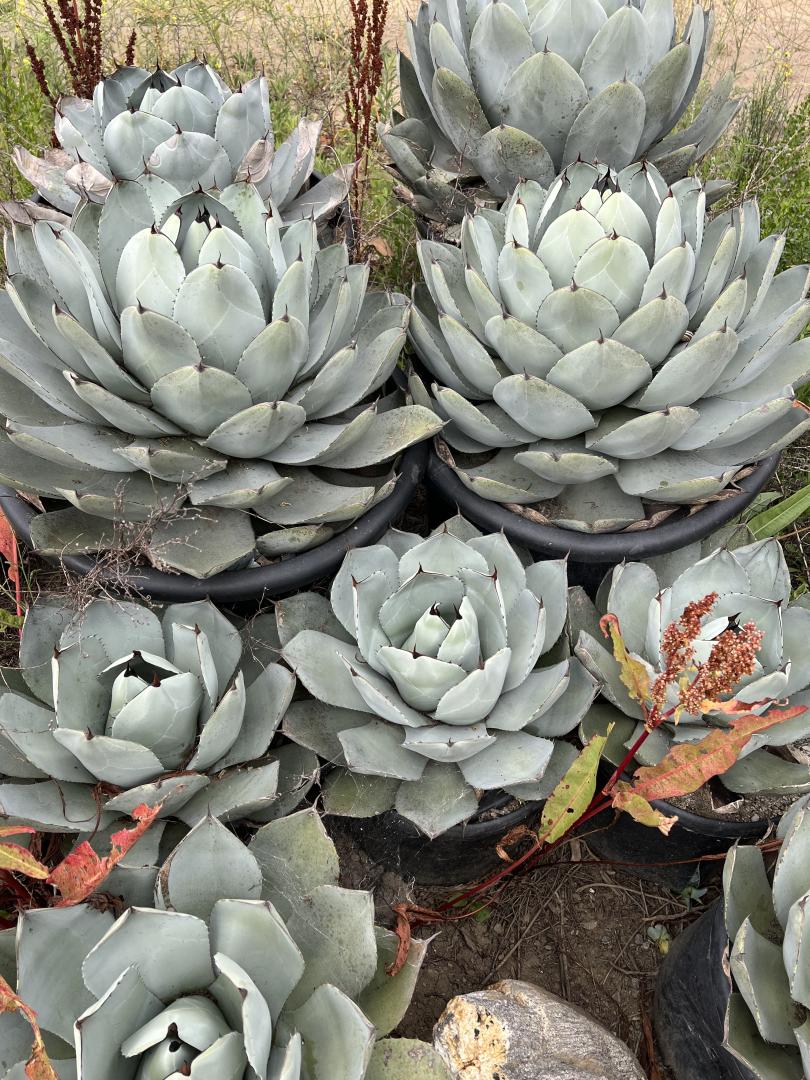
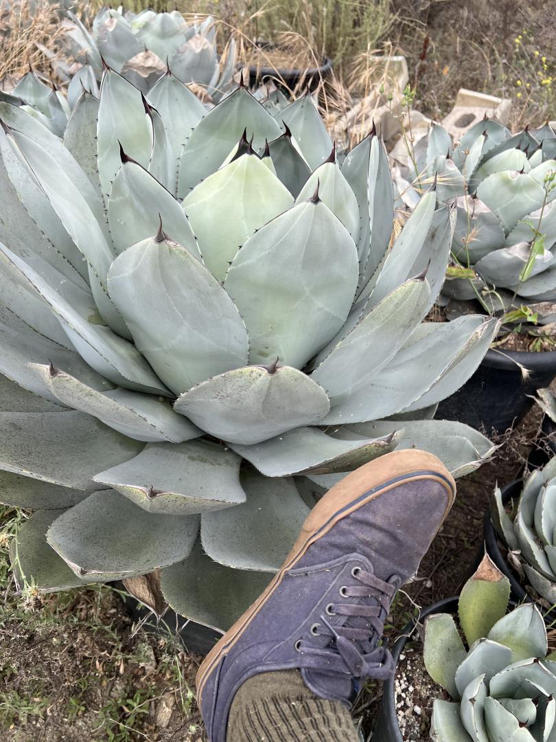
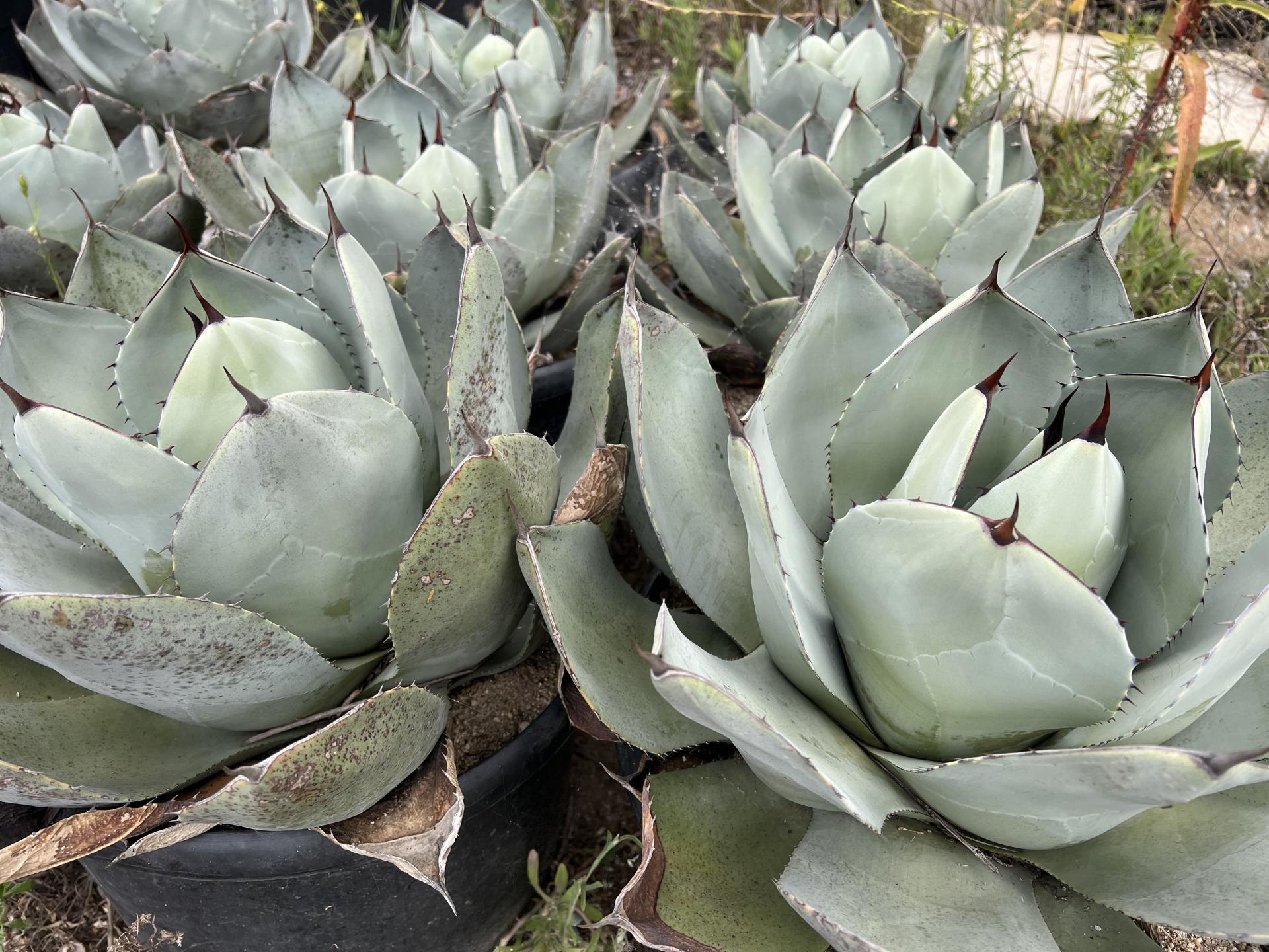
 1 pointI have some absolute beautiful specimen agave Parryi in 25 gal tubs and squat 7s. Instant showpiece. 25 gal. $100 7gal. $50 Located in. SoCal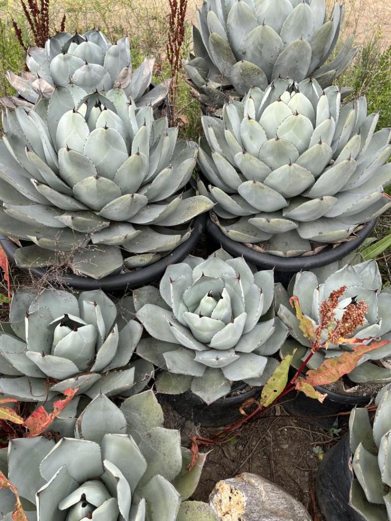
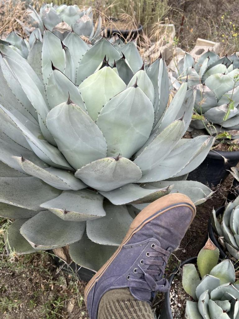
 1 point
 -
It is, lol.. I get having to purchase by mail ..do it often enough but look at road trips this way, no middle man to rough plants in the mail / someone sending me the smallest specimen possible. Can talk with X plant guru / see if there is anything else that i might be able to cross off my list, ...and the adventure to and from is fun as well. Getting up at 4AM to be at the Huntington or L.A. Arboretum by ..9 or 10AM for a plant sale = 100% worth it. Another fun aspect, ...the people passing next to you who look over at your car full of plants while on the road home. Priceless..1 point