Jump to content
  • WELCOME GUEST

    It looks as if you are viewing PalmTalk as an unregistered Guest.

    Please consider registering so as to take better advantage of our vast knowledge base and friendly community.  By registering you will gain access to many features - among them are our powerful Search feature, the ability to Private Message other Users, and be able to post and/or answer questions from all over the world. It is completely free, no “catches,” and you will have complete control over how you wish to use this site.

    PalmTalk is sponsored by the International Palm Society. - an organization dedicated to learning everything about and enjoying palm trees (and their companion plants) while conserving endangered palm species and habitat worldwide. Please take the time to know us all better and register.

    guest Renda04.jpg

Some more road side shots


Recommended Posts

Posted

Since I have received a lot of positive input on some of my roadside shots I have a few more.  And, I would like to thank Gileno for his documentation of his trip.  I find it a good way to make the trip more interesting looking for palm and related shots.  This trip we took up to Boa Vista, Roraima leaving early Monday morning and returning on Saturday this week.  The trip to Boa Vista is on BR 174 and is about 800 kms.  If the road were in good shape it would be an easy trip. Unortunately like many Brazilian highways the highway is a mess.  The holes sometimes look like they will swallow your car.  This highway was only paved 6 years ago and is already in a sad state of disrepair.  First they don't apply a good base to the road and it has a thin layer of asphalt.  Since the only way to move goods into Roraima is from Manaus by truck the road gets a lot of abuse.  But, that is Brazil, one of the negative things of life here.

About 200 kms from Manaus you enter the Waimiri Atroari Indian Reservation and continue through it for 200 kms.  You are advised not to stop, not to take pictures of the Indians, etc.  It is a beautiful trip as the forest is totally intact in this portion.

The road through the Indian Reservation - Waimiri Atroari.

We did see some indians hunting with bows and arrows on the return trip.

BR174IndianReservation.jpg

Roadside stop. I was with my copilot and personal manager in the forest.

raodstopBR174.jpg

Some roadside palms.  The Eutrepe Pecatoria is very abundant in the area.  And, the M. flexuosa are alwasy present.

RoadsidePalmsReservaBR174.jpg

The area has a very high population of the Buritirana - Mauritiella armata .  Some areas were almost pure stands of them.  I think this is a beautiful palm

BuritiranaReserva174.jpg

Don Kittelson


LIFE ON THE RIO NEGRO

03° 06' 07'' South 60° 01' 30'' West

Altitude 92 Meters / 308 feet above sea level

1,500 kms / 932 miles to the mouth of the Amazon River


Manaus, Amazonas, Brazil - A Cidade da Floresta

Where the world´s largest Tropical Rainforest embraces the Greatest Rivers in the World. .

82331.gif


Click here to visit Amazonas

amazonas2.jpg

Posted

On the way up to Boa Vista you change hemispheres.  Here I have one foot in the Northern hemisphere and one in the south.  Unfortunately the monument is in as bad a state as the highway.

DKEquador.jpg

This scene is near Rorainopolis, one of our stops.  The town does not even have cell phone service yet, and for Brazil that is uncommon.  The most common palms in land converted from forest is the Inaja, Attalea maripa.  This was shot in a rain shower, I thought the rainbow made a nice effect.

AttaleasinrainstormRorainopolis.jpg

Much of the land along the highway north of the indian reserve is pasture land.  This goes back from 500 meteres to 1000 meters from the highway normally.  I do not know what the small palms in from of the M. flexuosa are, but they look like some sort of Attalea.

Cows74-1.jpg

Here is shot of the state of the highway.  At least you get good practice at quick reaction pothole dodging.

PotHolesBR174.jpg

Don Kittelson


LIFE ON THE RIO NEGRO

03° 06' 07'' South 60° 01' 30'' West

Altitude 92 Meters / 308 feet above sea level

1,500 kms / 932 miles to the mouth of the Amazon River


Manaus, Amazonas, Brazil - A Cidade da Floresta

Where the world´s largest Tropical Rainforest embraces the Greatest Rivers in the World. .

82331.gif


Click here to visit Amazonas

amazonas2.jpg

Posted

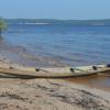
As you near half way to Boa Vista the road crosses the Rio Branco.  This is the river on which Boa Vista is situated and the major tributary of the Negro River which flows past Manaus.  The dry season is now moving into full force here and the river is dropping quickly in level.

RioBrancoBridge.jpg

A roadside farm house surround by Attalea maripa.

FarmHouse.jpg

The end of the road, the Aipana Hotel in Boa Vista.

PoolAipana.jpg

Don Kittelson


LIFE ON THE RIO NEGRO

03° 06' 07'' South 60° 01' 30'' West

Altitude 92 Meters / 308 feet above sea level

1,500 kms / 932 miles to the mouth of the Amazon River


Manaus, Amazonas, Brazil - A Cidade da Floresta

Where the world´s largest Tropical Rainforest embraces the Greatest Rivers in the World. .

82331.gif


Click here to visit Amazonas

amazonas2.jpg

Posted

My pleasure Zac.  I am glad you enjoy seeing a bit of the country around here.  

Here is a nice Açai specimen, Euterpe precatoria.  It was growing in the Indian Reservation.

Eutrepeprecatoria-1.jpg

Don Kittelson


LIFE ON THE RIO NEGRO

03° 06' 07'' South 60° 01' 30'' West

Altitude 92 Meters / 308 feet above sea level

1,500 kms / 932 miles to the mouth of the Amazon River


Manaus, Amazonas, Brazil - A Cidade da Floresta

Where the world´s largest Tropical Rainforest embraces the Greatest Rivers in the World. .

82331.gif


Click here to visit Amazonas

amazonas2.jpg

Posted

Your countryside is much more interesting than the  countryside around here. Well, it is interesting botanically here, but I basically know all of the plants around here and it has gotten slightly boring.

Zac

Zac  

Living to get back to Mexico

International Palm Society member since 2007

http://community.webshots.com/user/zacspics - My Webshots Gallery

Posted

Don:

Your pictures rock.  

Especially the one with Dorothy Lamour in her sarong . . .

AND the pictures of the house the roadside and the river, I guess I'm so stoked I'm ready to croak . . .

More of the same.

Let's keep our forum fun and friendly.

Any data in this post is provided 'as is' and in no event shall I be liable for any damages, including, without limitation, damages resulting from accuracy or lack thereof, insult, or lost profits or revenue, claims by third parties or for other similar costs, or any special, incidental, or consequential damages arising out of my opinion or the use of this data. The accuracy or reliability of the data is not guaranteed or warranted in any way and I disclaim liability of any kind whatsoever, including, without limitation, liability for quality, performance, merchantability and fitness for a particular purpose arising out of the use, or inability to use my data. Other terms may apply.

Posted

Dave - don't croak! Get your swooning couch instead.

Scott

San Fernando Valley, California

Sunset Climate Zone 18

Posted

Dear Amazon DK  :)

The Pictures are very nice,but i want to know

wheather these pictures were shot during

early morning or in the evenings.as they

appear slightly dark in contrast ?

thanks for sharing those lovely stills,

Love,

Kris.

love conquers all..

43278.gif

.

Posted

Kris,

Most of the pictures were taken early morning.  We left Manaus at 0430.   So, it was around 0700 when a lot of the pictures were shot.

dk

Zac,

You would probably get used to the countryside around here too.  After a while any place becomes I guess what you would call normal.  But, there are a lot more plants to learn about for sure and it is a beautiful area.

Dave,

Thanks, I hope you can come see for yourself some day.

dk

Don Kittelson


LIFE ON THE RIO NEGRO

03° 06' 07'' South 60° 01' 30'' West

Altitude 92 Meters / 308 feet above sea level

1,500 kms / 932 miles to the mouth of the Amazon River


Manaus, Amazonas, Brazil - A Cidade da Floresta

Where the world´s largest Tropical Rainforest embraces the Greatest Rivers in the World. .

82331.gif


Click here to visit Amazonas

amazonas2.jpg

Posted

I totally enjoy seeing all the photos you take on your travels about Brasil, then I check my Brazil map to see exactly where you went.  

Outside of the Indian reserve do you pass by or thru many towns or see many farms on your way up there?  My map shows a side road that goes NE from Boa Vista to the Guyana border.  That sounds like it might be an interesting side trip to make too.  Know anything about that?   Also how long a drive is it from Boa Vista to the Venezuela border?  

Keep posting pics please!

Hawaii Island (Big Island), leeward coast, 19 degrees N. latitude, south Kona mauka at approx. 380m (1,250 ft.) and about 1.6 km (1-mile) upslope from ocean.


No record of a hurricane passing over this island (yet!).  

Summer maximum rainfall - variable averaging 900-1150mm (35-45") - Perfect drainage on black volcanic rocky soil.  

Nice sunsets!

Posted

Al,

I am glad you enjoy my pictures.  From the end of the reservation to Boa Vista you go through three of the larger towns in Roraima, Roraimopolis (where we are developing the lumber business now), Cacacarai (on the crossing of the Rio Branco), and Mucajai (which is 80 kms from Boa Vista.  None of these towns are very large though, maybe 30 thousand people or so each.  It is I believe about 3 or 4 hours to Venezuela from Boa Vista.  I intend on making the trip at some time.  There are some very high mountains up toward the border.  Most notably Monte Roraima.

Most of the trip outside of the reservation is ranch and farm land along the road side, at most a few thousand meters in from the road.  At Mucajai the forest transistions into the savanna land , Campos Lavrados.

dk

Don Kittelson


LIFE ON THE RIO NEGRO

03° 06' 07'' South 60° 01' 30'' West

Altitude 92 Meters / 308 feet above sea level

1,500 kms / 932 miles to the mouth of the Amazon River


Manaus, Amazonas, Brazil - A Cidade da Floresta

Where the world´s largest Tropical Rainforest embraces the Greatest Rivers in the World. .

82331.gif


Click here to visit Amazonas

amazonas2.jpg

Posted

Al,

The trip to Guyana must be interesting.  The road does not go all the way through though.  There is a project to finish this so that the state will have access to the Caribbean port in Guyana.

dk

Don Kittelson


LIFE ON THE RIO NEGRO

03° 06' 07'' South 60° 01' 30'' West

Altitude 92 Meters / 308 feet above sea level

1,500 kms / 932 miles to the mouth of the Amazon River


Manaus, Amazonas, Brazil - A Cidade da Floresta

Where the world´s largest Tropical Rainforest embraces the Greatest Rivers in the World. .

82331.gif


Click here to visit Amazonas

amazonas2.jpg

  • 1 month later...
Posted

Sorry I missed this earlier Don.  Great shots.

Tampa, Interbay Peninsula, Florida, USA

subtropical USDA Zone 10A

Bokeelia, Pine Island, Florida, USA

subtropical USDA Zone 10B

Posted

(amazondk @ Nov. 06 2006,01:14)

QUOTE
Dave,

Thanks, I hope you can come see for yourself some day.

dk

I hope so, too!

Let's keep our forum fun and friendly.

Any data in this post is provided 'as is' and in no event shall I be liable for any damages, including, without limitation, damages resulting from accuracy or lack thereof, insult, or lost profits or revenue, claims by third parties or for other similar costs, or any special, incidental, or consequential damages arising out of my opinion or the use of this data. The accuracy or reliability of the data is not guaranteed or warranted in any way and I disclaim liability of any kind whatsoever, including, without limitation, liability for quality, performance, merchantability and fitness for a particular purpose arising out of the use, or inability to use my data. Other terms may apply.

Posted

Awsome pictures. I always enjoy your pictures.

Meteorologist and PhD student in Climate Science

Create an account or sign in to comment

You need to be a member in order to leave a comment

Create an account

Sign up for a new account in our community. It's easy!

Register a new account

Sign in

Already have an account? Sign in here.

Sign In Now


  • Recently Browsing

    • No registered users viewing this page.
×
×
  • Create New...